
“Bas-relief showing the Claudian Harbor,” an illustration from Ancient Rome in the Light of Recent Excavations by Rodolfo Lanciani, published in 1889 by Houghton Mifflin and Company. Lanciani (1845-1929) was an Italian archaeologist best know for his map of the ancient city of Rome, which he called the Forma Urbis Romae. The map consists of a series of 46 maps, each 25 by 36 inches, issued between 1893 and 1901, and is still widely consulted today.
Frances Glessner notes in her journal reading Lanciani’s book in early February 1890, just before her one and only trip to Europe with her husband John and daughter Fanny. While in Rome, the Glessners were introduced to Lanciani and his wife Elena. He provided guidance on sites to visit, specific pieces to see at the museums, and places to shop.
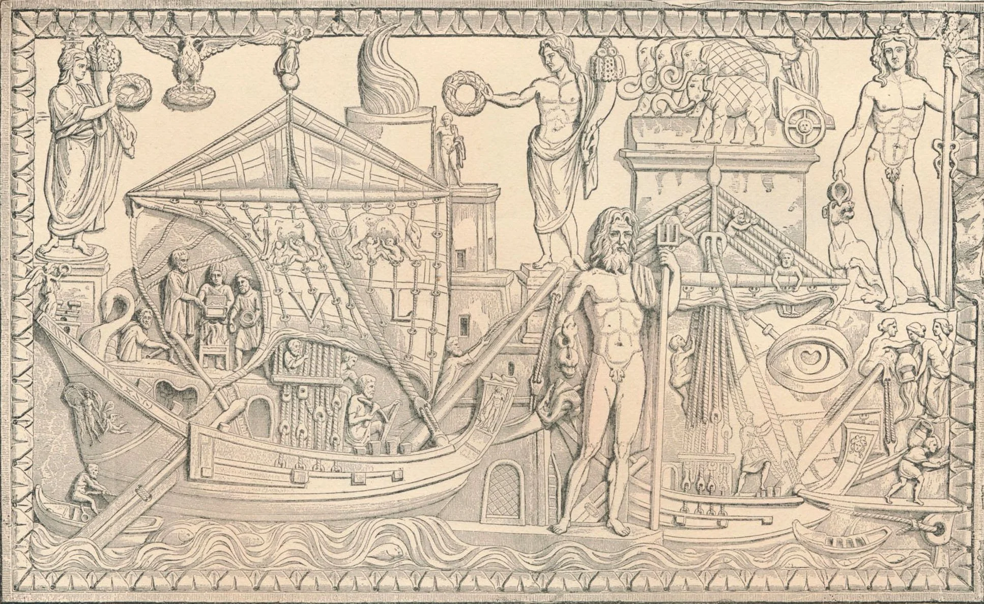
The illustration shows what is known as the Portus relief, an ancient Roman marble relief of the 2nd or 3rd century AD excavated in 1863 and now housed at the Torlonia Museum in Rome. It shows the bustling port of Portus at the mouth of the Tiber River, established by the emperor Claudius. At upper center in the relief is a depiction of the famous lighthouse with a large flame shooting out from the top. The relief, which measures four feet in diameter, was on view at the Art Institute of Chicago from March to June 2025, as part of the exhibit, Myth and Marble: Ancient Roman Sculpture from the Torlonia Collection.